
Is a region in southeastern Peru, bordering Brazil, Bolivia and the Peruvian regions of Puno, Cusco and Ucayali, in the Amazon Basin. Its capital is the city of Puerto Maldonado.
The name of the region is derived from the Madre de Dios River, ultimately a tributary of the Amazon, and named by ethnic Spanish colonists. It is a very common Spanish language designation for the Virgin Mary, literally meaning Mother of God.
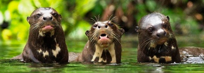
The region is almost entirely low-lying Amazon rainforest. The climate is warm and damp, with average temperatures around 26 °C (79 °F) [max.: 34 °C (93 °F), min.: 21 °C (70 °F)]. The rainy season is from December to March, when torrential rainfall causes rivers to swell and often overflow their banks. Annual precipitation can be as much as 3 metres (9.8 ft).
The north-western boundary with the Cusco Region is known as the Isthmus of Fitzcarrald, a series of small and low mountains that separate the Madre de Dios River and the Urubamba/Ucayali River basins.
Notable rivers in the Madre de Dios River watershed are the Inambari, Tambopata, Manu, Tahuamanu, Las Piedras, also known as Tacuatimanu River, Heath, Acre and Los Amigos.
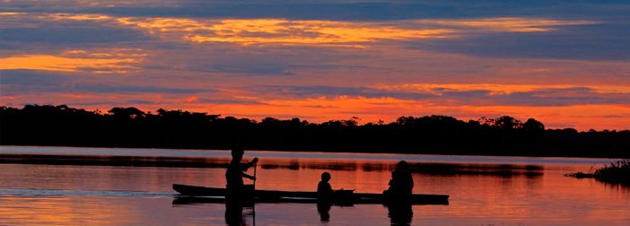
Due to the vast size of the area and its low population density, rivers provide the best way of getting from one town to another. Human activity is invariably confined to riverbanks. A number of explorers have searched for the lost city of Paititi in the jungle within the region. A new road that opened in early 2011 through the area will connect Brazil and Peru for trade, and change the isolation of this area.
The only important highway is between the Peruvian cities of Puerto Maldonado and Cusco, 510 kilometres (320 mi) away in the Cusco Region. It is part of the newly built Interoceanic Road between the Pacific and Atlantic Oceans, passing by the border town Iñapari on the Acre river. Flights between Cusco and Puerto Maldonado remain the most common and quicker method of transport between the two.
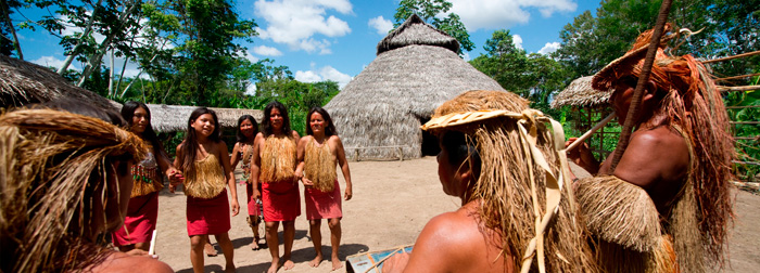
From Puerto Maldonado a road about 55 kilometres (34 mi) long leads to the mining town Laberinto (“Labyrinth”). A second road is between the village Cusco and Itahuania (into the Manú National Park). It is a roughly 350 kilometres (220 mi)-long single-track road that is hard to travel in the rainy season. It also has a dirt road to the native community of Infierno (“hell”), where the Ese’ejas (or Guarayos) live. Their chief is Agustín Shapaja, who led the famous expedition to the Candamo. He was featured in the documentary El Candamo, la Ultima Tierra sin Hombres (The Candamo, The Last Land without Men).
The region is divided into three provinces (provincias, singular: provincia), which are composed of 11 districts (distritos, singular: distrito). The provinces, with their capitals in parentheses, are:
- Manu (Salvación)
- Tahuamanu (Iñapari)
- Tambopata (Puerto Maldonado)
- Amarakaeri Communal Reserve
- Purús Communal Reserve
- Tambopata National Reserve
- Refugio Amazonas